i-am.ws |
Mobile Navigation
Going through some folders with software development projects from the past, I came across this one, which is dating back to the spring of 2003. One of those attempts to get rich quick :) with a startup. The idea was to have a small mobile device with GPS that would show you the map of where you were and then allow you to get directions to the closest coffee shop, gas station, hotel, etc. And then of course sell those ads commercially. Hey, this was still (the end of) the dot-com era. Sounds familiar? Yes, four years later Apple introduced the iPhone, so we're definitely talking here about "prior art".
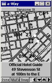
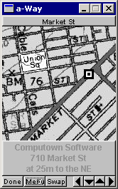
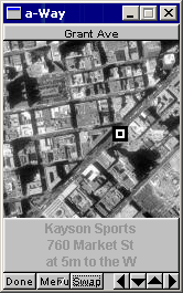
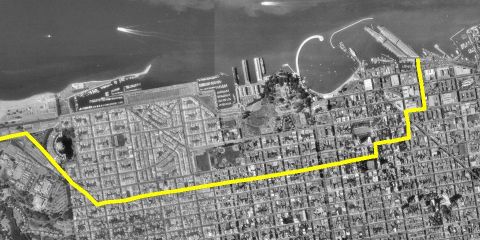
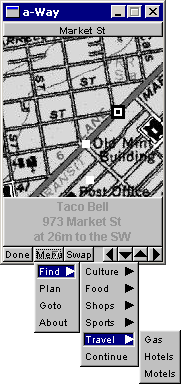
The app got as far as a functioning prototype with data for downtown San Francisco. You see it here searching for hotels, while walking along Market Street. It had maps and aerial photos from the Microsoft TerraServer. Which is an interesting piece of history, because Microsoft got the maps from the USGS, but bought the aerials from the Russians. Not surprising that it only contained photos from space of the USA. :-)
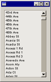
I got my location information about restaurants, shops, theaters, etc from an on-line Yellow Pages database. I also needed a vector based map, because otherwise you can't do proper path planning. Found that in a database from the US Census Bureau called Tiger. The shortest path calculation was of course based on Dijkstra's algorithm.
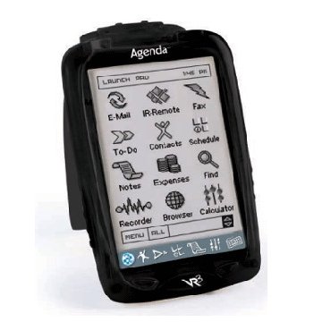
In 2003 the mobile devices of the time were PDAs. Remember those? One startup company called "Agenda" developed a model that was fully based on Linux. Through the serial port and using ppp, you could even telnet and ftp into the device. The GUI couldn't do X-Windows – not enough processing power – but someone created a port of FLTK for it. A nice thing was that you could compile the same code base for desktop Linux, Windows or the Agenda.
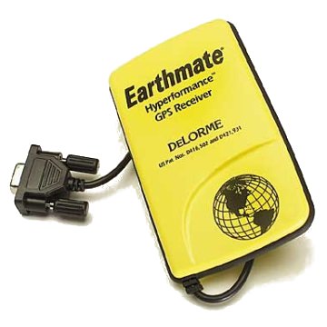
The GPS to use was an easy choice, always been a fan of DeLorme units. It connected to the PDA through a serial cable.
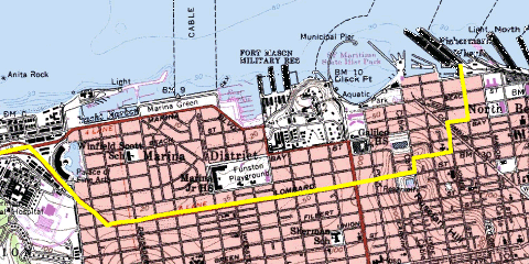
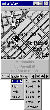
As you can see below, there were various categories to pick from. Or you could do a "Go To" by clicking somewhere on the map. The little white dots are the route to get to your destination. Or you could pick a street name from the Tiger database.
To be honest, by now I have no idea how this could have scaled to cover more than just a city. But it was lots of fun to develop. And it worked.
 |
 |
 |
Posted at 01:20PM Jan 19, 2014 by WWWillem in Software |